Planet and FarmQA Drive Higher Farm Margins With Precision Agronomy at Scale
We recently joined Planet for a webinar on precision agronomy and the article below outlines how near-daily satellite imagery combined with FarmQA tools is helping agronomists optimize inputs, direct scouting, and increase farm margins.
Originally published on Planet.com, republished here with permission.
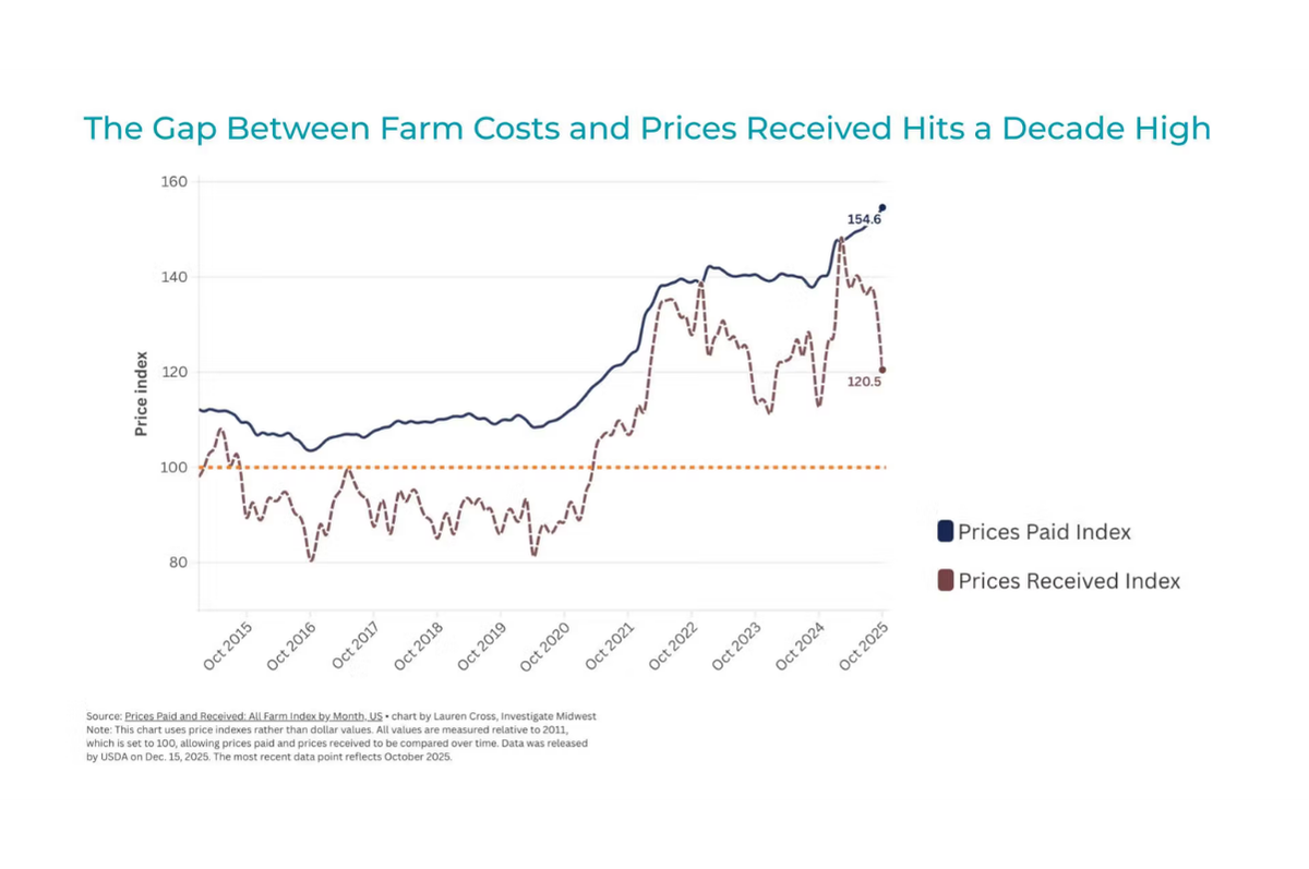
In the current agricultural landscape, the margin for error is narrowing. As the gap between fluctuating commodity prices and rising inputs (like seed, fertilizer, and equipment) reaches a decade high, growers and agronomists are forced to find new ways to get more out of every acre.
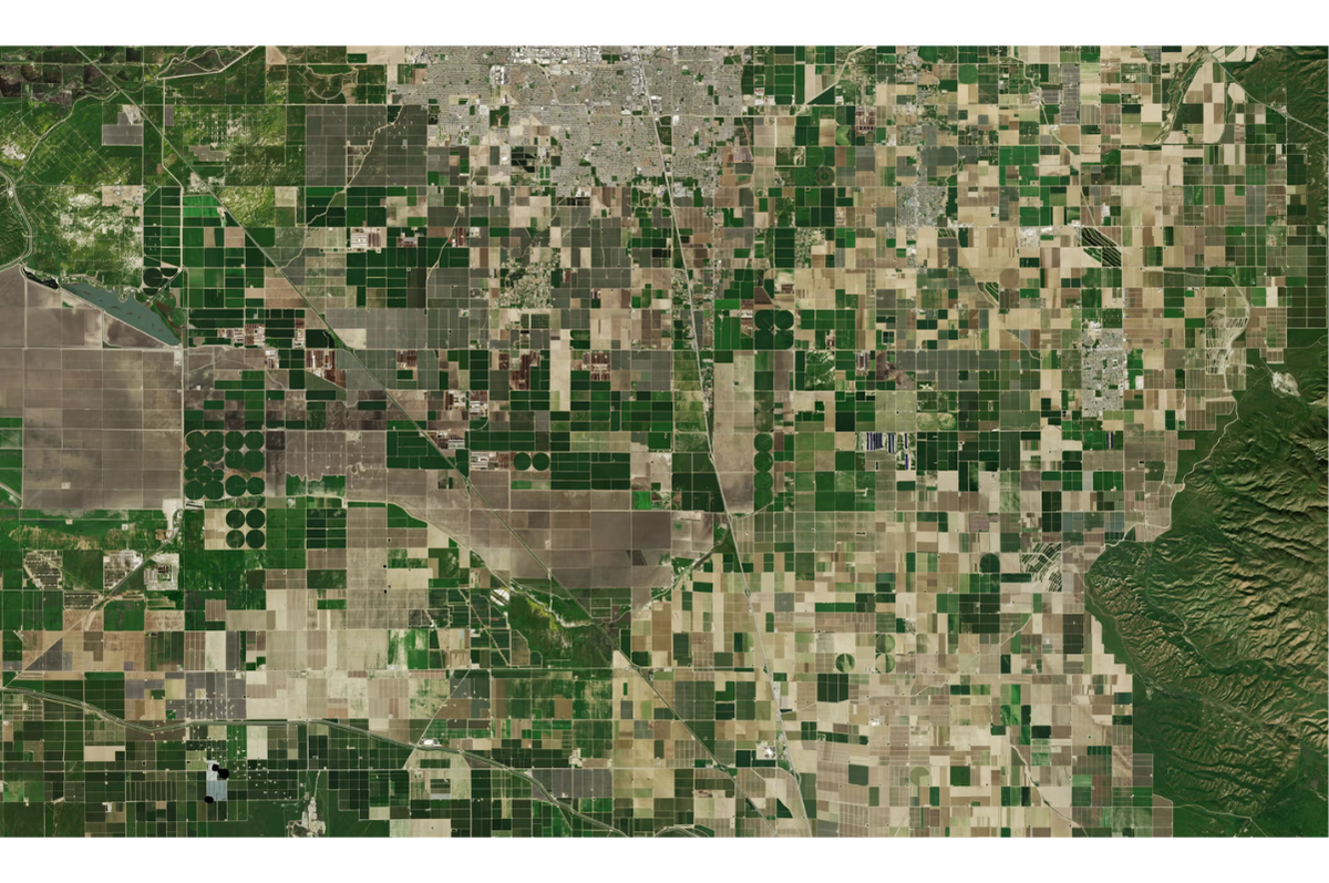
A uniform approach to field management is no longer an economically viable strategy. Variability is inherent in every field, driven by soil type, drainage, and localized pest or disease pressure. To maintain profitability, the industry is shifting toward precision agronomy: an approach that uses data to apply the right resources, in the right amount, at the right time.
Moving Beyond the Cloud Constraint
The primary hurdle for satellite-based crop monitoring has historically been reliable revisit frequency. Traditional satellites may only pass over a field every week or two. If that pass happens on a cloudy day, an agronomist might go nearly a month without a look at crop health.
Planet satellites address this challenge by imaging Earth’s landmass on a near-daily basis. This high-revisit rate increases the probability of capturing cloud-free imagery during critical growth stages. For a partner like FarmQA, this constant stream of multispectral data provides the foundation for identifying field variability as it emerges, enabling agronomists to prescribe optimized field inputs and mitigate pest damage earlier.
From Pixels to Prescriptions
Data is only valuable when it leads to action. The integration of Planet data with the FarmQA platform focuses on turning these near-daily scans into field-ready decisions through several key workflows:
- Directed Scouting: Instead of manually checking fields intermittently, scouts can use this technology-driven approach to field management at scale. Using the FarmQA mobile app to access vegetation indices like NDVI or MSAVI, they can navigate directly to underperforming areas and document issues such as specific weed pressure or nutrient deficiencies with geo-tagged photos and notes, even when offline in remote regions.
- Variable Rate Prescriptions: These digital, map-based plans tell agricultural equipment such as tractors, sprayers, planters how much seed, herbicide, fertilizer, or water to apply to specific areas of a field. Planet 3.7 meter resolution imagery allows agronomists to create sub-field management zones. And in FarmQA, these zones are used to write variable rate prescriptions that can be exported as machine-readable files. This ensures a more precise application backed by data.
- Harvest Progress Tracking: The FarmQA platform helps operations managers monitor crop performance in near-real time. Tracking data like harvested acreage and yield across entire regions helps them make business decisions, analyze performance, and meet regulatory requirements. This visibility is critical for logistical planning, particularly for crops like sugar beets that require tight coordination between the field and the processing facility.
Collaborative Innovation for Future Resilience
The partnership between Planet and FarmQA highlights a collaborative approach to solving modern agricultural challenges. By combining global, near-daily monitoring with a specialized agronomic toolset, together we are helping the industry transition from reactive scouting to proactive, data-driven management.
To see these technical workflows in action, including a demo of how FarmQA handles high volumes of Planet imagery to create management zones, watch a recording of our recent webinar, Driving Higher Farm Margins With Precision Agronomy From FarmQA and Planet.