
Zones & Variable Rate Prescriptions
Turn field variability into a plan for action
Build smarter zones. Write field-ready prescriptions.
Use soil tests, imagery, yield data, and other spatial layers to build management zones that reflect what’s happening across the field. Assign rates by zone or use formulas to calculate rates from soil test data and agronomic targets. Then bring your maps, prescriptions, field information, and supporting details together in a map book that’s ready to share or take to the field.
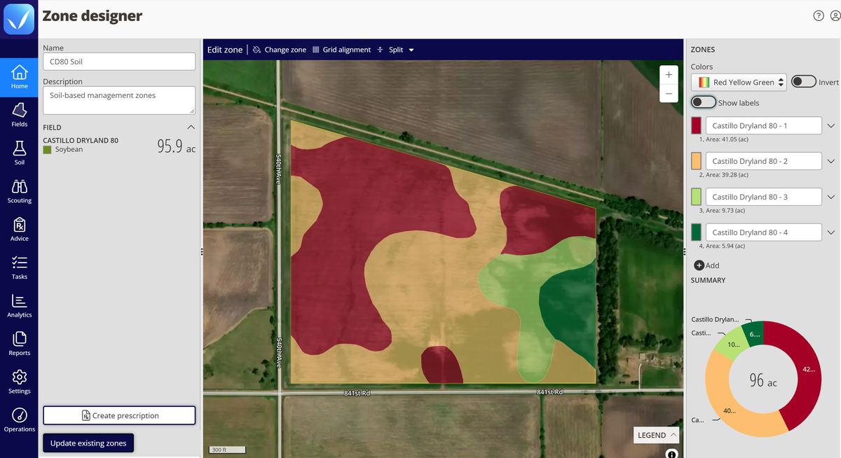
Choose the right approach for every field
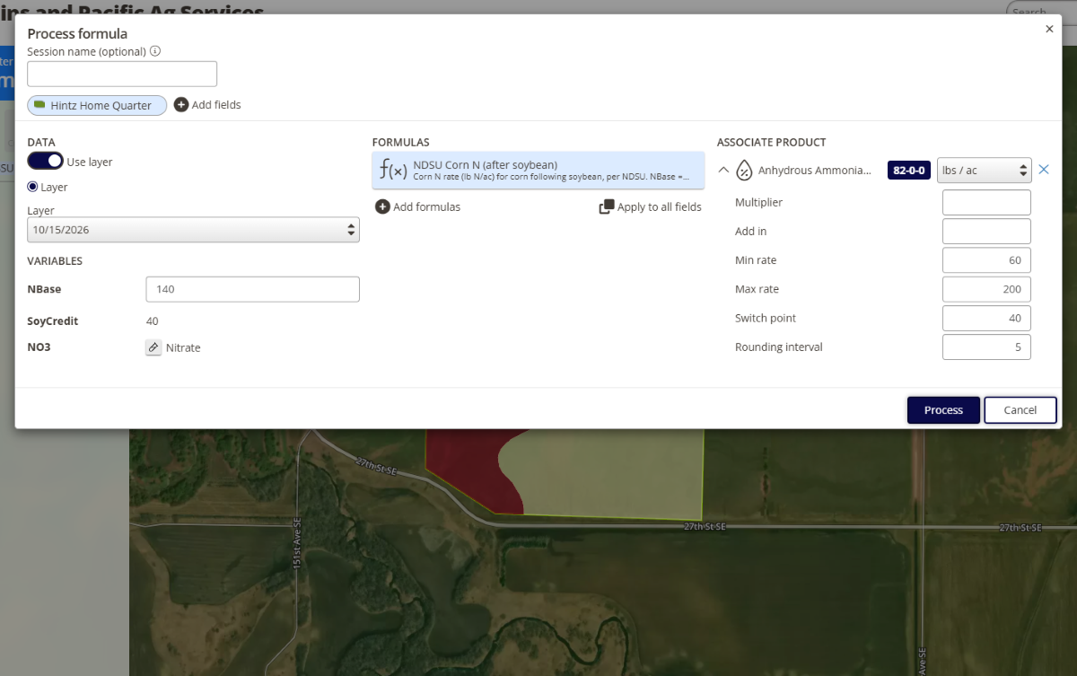
Not every field needs the same level of precision. Build management zones and assign rates to create straightforward variable rate prescriptions, or use formula-based calculations to turn soil test data and agronomic targets into prescriptions across multiple fields.
Need maps without prescriptions? Map books work on their own, giving your team organized field maps and data to take to the field or shop.
Build zones from the data you trust
Good prescriptions start with good zones. Build custom management zones from satellite imagery, yield history, elevation, soil type, electrical conductivity, or other spatial data you already have. If one data source doesn’t tell the whole story, use the layers that do.
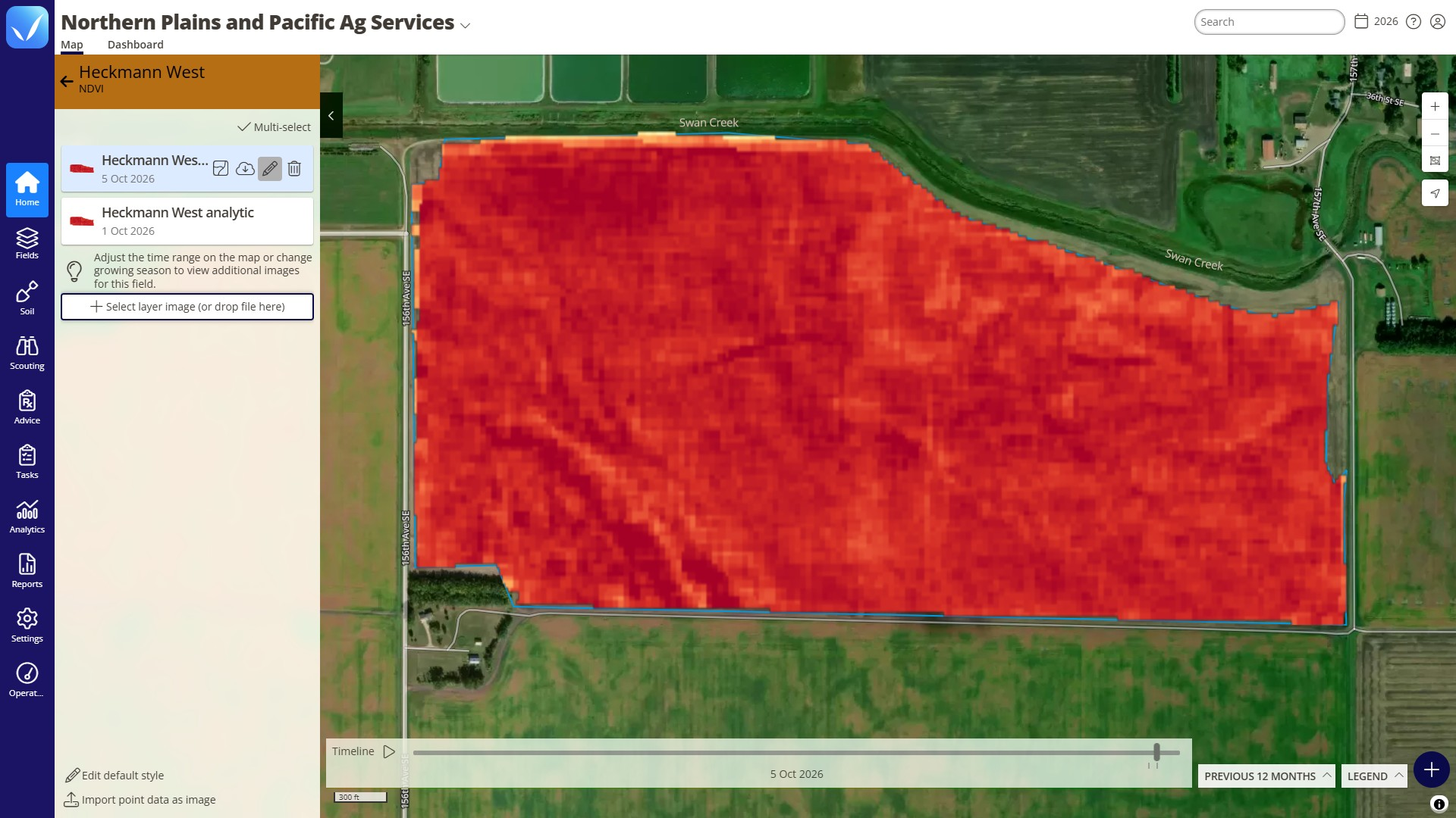
Use current and historical NDVI imagery to identify patterns in crop vigor and variability, so you can start evaluating field trends without waiting years to build your own history.
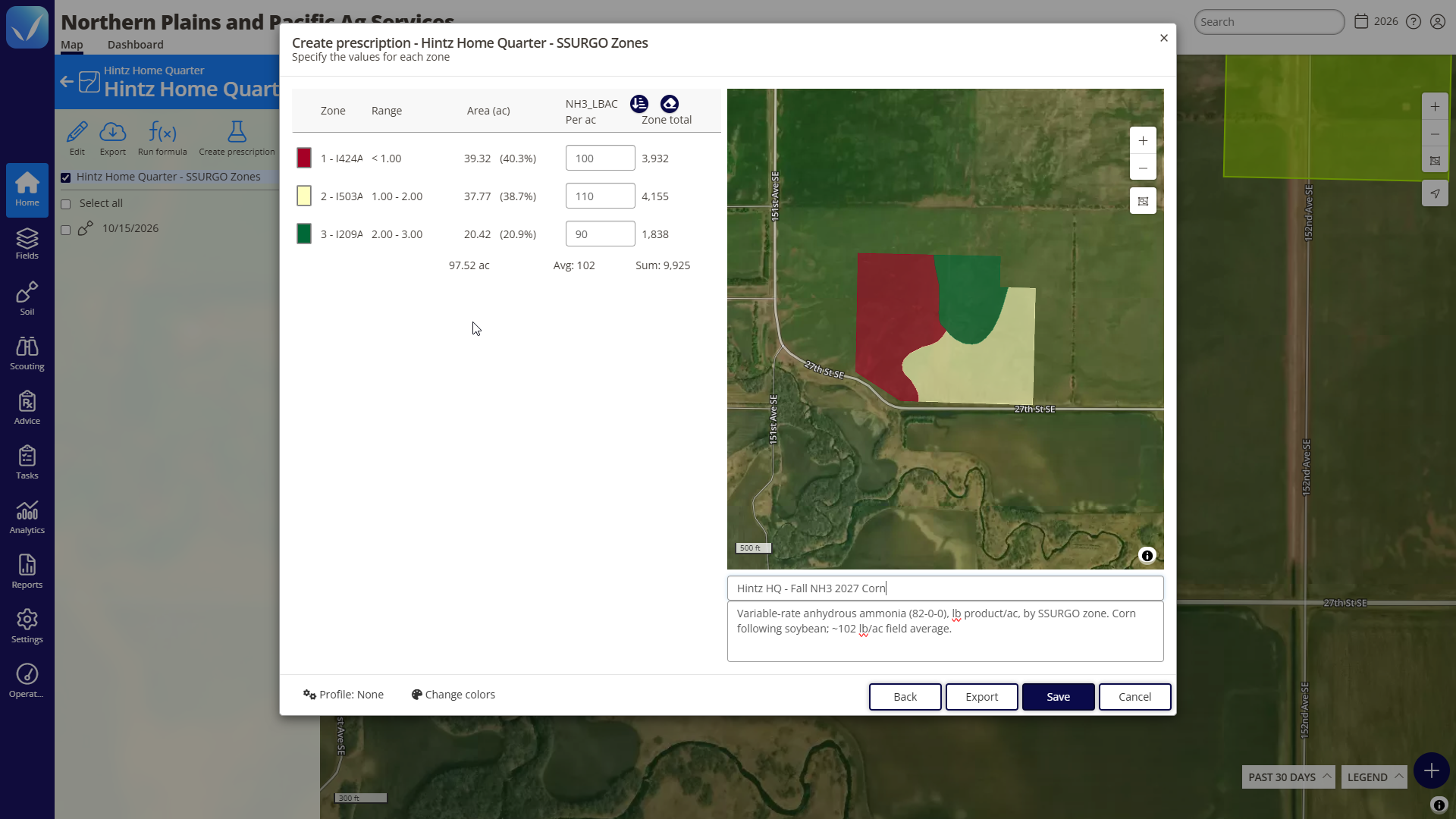
Zone-based prescriptions
And you don’t have to start over next season. Reuse existing management zones and write new prescriptions against them year after year.
Put your agronomic formulas to work
From prescription to application
Prescriptions, recommendations, and other outputs created in QA Advisor can move back into John Deere Operations Center and CNH FieldOps and ultimately into the cab for execution by John Deere, Case IH, New Holland, and STEYR equipment.
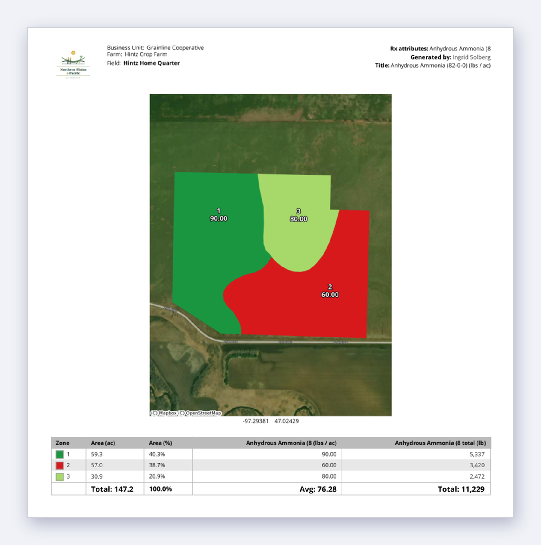
Maps made for the field
Turn field information into an organized Map Book your team can carry into the field, shop, or grower meeting. Draw or import field boundaries, assign crops, and bring together soil results into maps for a single field or an entire operation.
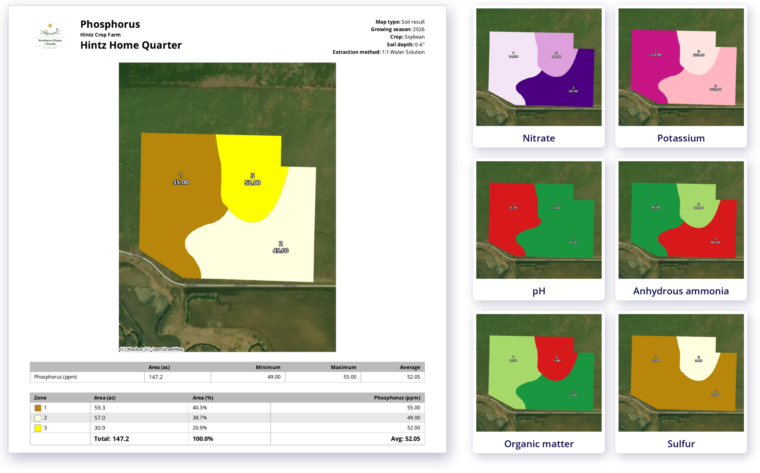
Build on what you know
Pricing that fits your operation
Whether you’re an independent agronomist or managing a large team, we offer flexible pricing based on your users and the capabilities you need. Add more as your operation grows.
SUPPORT
Real people. Practical support.
Have a question? Our team is here to help you get the most out of your FarmQA products. Whether you’re getting started, learning a new feature, or working through an issue, you can reach us by phone or email, or find answers in our online Support Center.